The SourceTrace platform enables us to digitally collect and link data from cocoa farmers, farms and the communities allowing us to formulate plans for coaching farmers based on their needs.

EUDR Compliance Made Simple for Global Agri Supply Chains
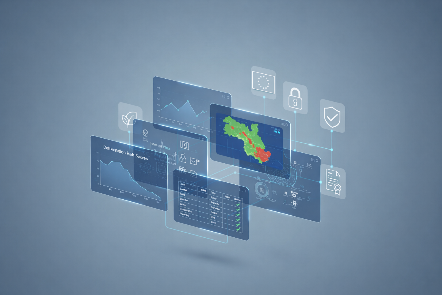
EUDR-compliant software enables exporters and EU importers to prove that products are legally sourced, fully traceable, and deforestation-free. It requires farm-level geolocation, risk assessment, and verifiable reporting aligned with strict EU regulations. SourceTrace delivers a single digital platform to meet these requirements with speed and confidence.
What Is the EU Deforestation Regulation?
The EU Deforestation Regulation mandates that regulated commodities entering the EU must not contribute to forest loss after December 31, 2020. Companies must submit due diligence data proving origin, legality, and low deforestation risk under the EU Deforestation Regulation framework.
How SourceTrace Supports a Deforestation-Free Supply Chain
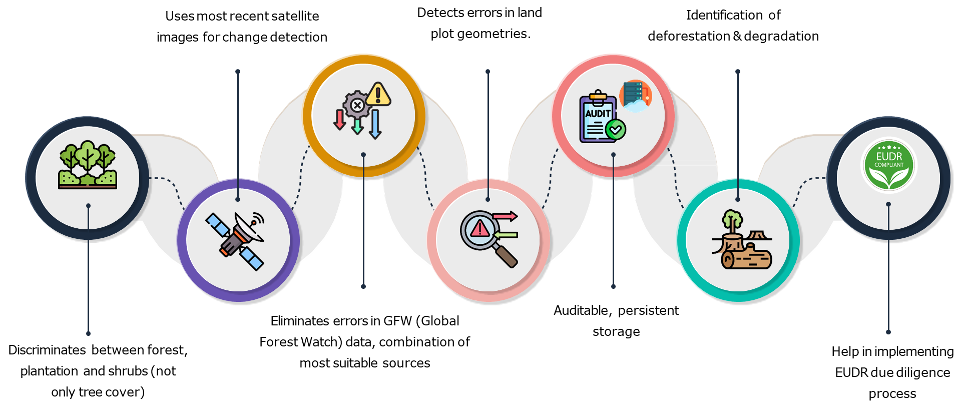
SourceTrace helps businesses build a deforestation-free supply chain using field-proven digital tools and satellite intelligence to meet EUDR compliance requirements. Designed for complex, multi-country sourcing, our approach works even in remote, offline environments.
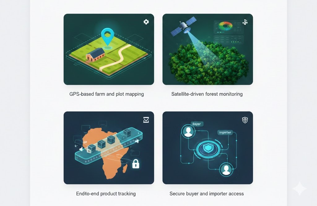
Key Benefits for African Exporters: Core capabilities include:
- GPS-based farm and plot mapping
- Satellite-driven forest monitoring
- End-to-end product tracking
- Secure buyer and importer access
One Platform. All the Tech.
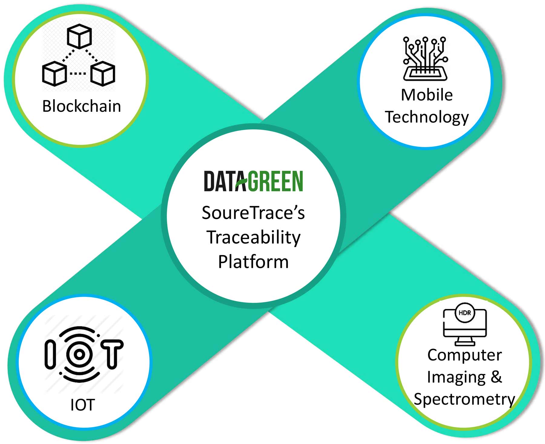
These capabilities enhance supply chain mapping accuracy while supporting ethical sourcing and the non-exploitation of Indigenous communities across African agricultural landscapes.
This approach complements seed traceability software, supports high-volume exporters seeking the best coffee traceability software in Africa, and aligns with regional needs such as coffee traceability software for Ethiopia.
Why Use Agricultural Traceability Software for EUDR?
Modern agricultural traceability software replaces manual records with verified, audit-ready data. SourceTrace’s platform connects farmers, processors, exporters, and EU buyers within a single, secure system.
Automated EUDR Reporting Tools That Save Time
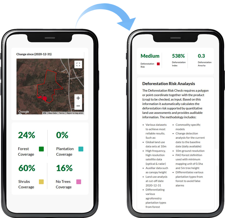
Our platform includes built-in EUDR-compliant reporting tools that automatically generate due diligence and deforestation risk reports. This automation reduces errors, improves data accuracy, and accelerates EU shipment approvals.
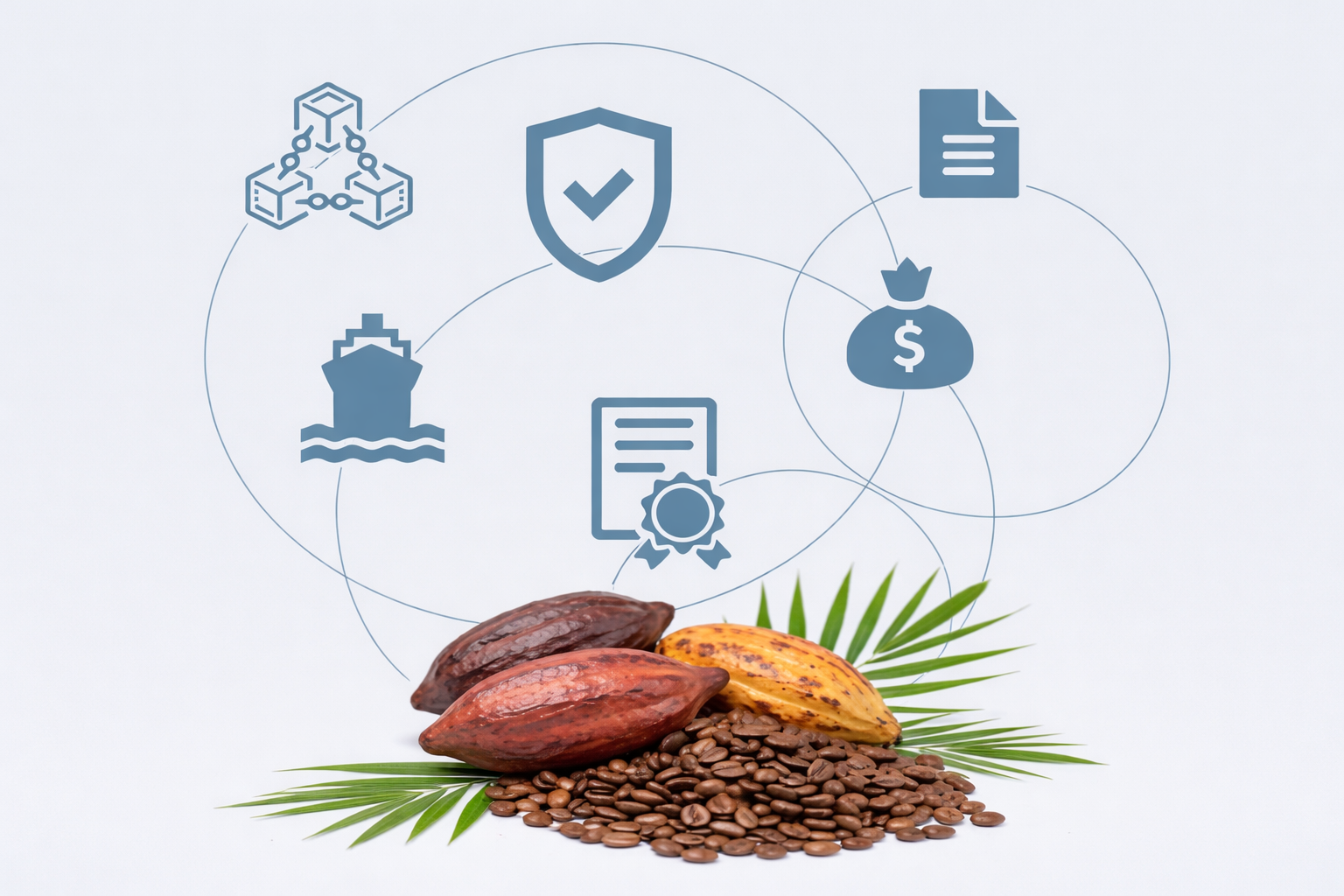
Commodities coverage with SourceTrace
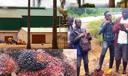
SourceTrace has covered over 37 countries in implementing sustainable value chains across coffee, cocoa, soy, palm oil, rubber, wood and cattle.
Key Takeaways:
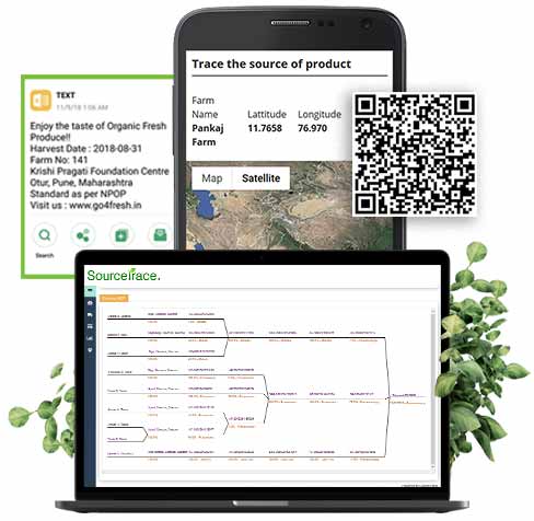
- Digital Geolocation is mandatory for European Union Trade.
- End-to-end traceability of goods using NFC Tags, RFID tags & QR Codes.
- Ability to generate EUDR format report.
- Automated document and process flow.
Frequently Asked Questions

How does EUDR compliance software support farmer and farm registration?+
EUDR compliance software supports digital registration of farmers and land parcels using mobile applications, offline capture, and later synchronization.
Does EUDR software offer GPS-based land mapping to meet geolocation requirements?+
Yes. Land-mapping functionality records accurate coordinates and links mapped plots to each farmer.
How does EUDR software support geospatial verification and satellite-based forest monitoring?+
It integrates satellite imagery and geospatial analysis to verify land use and deforestation risk.
Which agricultural commodities are supported by EUDR-compliant software?+
Coffee, cocoa, soy, cattle and leather, palm oil, natural rubber, and wood can be supported.
How does EUDR software help reduce shipment rejection risk?+
Auditable geolocation data, risk checks, and due diligence reports give importers clearer compliance evidence before shipment.
TESTIMONIAL
What our customers say
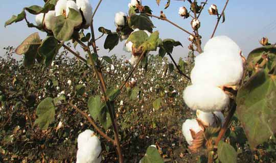
SourceTrace's platform helped us digitize the end-to-end value chain all the way from farm to the brands taking possession of the bales. Chetna could distinguish itself in the market and gained customer loyalty and premium pricing in a sustainable manner.
USAID-AIN project implemented by WorldFish is proud to introduce e-traceability on a pilot scale into Bangladesh using SourceTrace applications.
 Litul BaruahProgramme & Analytics Specialist, Laudes Foundation, India
We have been working with Sourcetrace for almost 4 years. The team has a very good understanding of the agriculture sector along with technical expertise in software development. We really appreciate the fact that they are open to new ideas and they are able to implement them in a time-bound manner.
Request a Demo
Case Studies
Chetna Organic Agriculture Producer Company – India
view case study
Small Farmers Agri-business Consortium – Haryana
view case study